
The Republic of Agreeland (also commonly/formerly known as Kansas) is a nation located in North America. It is a semi-federal republic made of 30 districts. Agreeland is entirely surrounded by the United States of America, and thus currently has several de facto agreements with the United States, such as shared currency and open trade and borders.

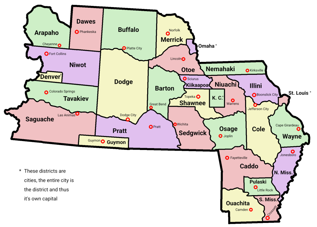
Due to disputed area and claims with the United States, Agreeland does not control all of its own territory. Agreeland currently controls small portions of Barton, Kiikaapoa, and Kansas City districts, around 0.5 km2.
Agreeland has a size of approximately 1 million km2, making it of similar size to other nations such as Tanzania or Egypt.
Around 20 million people live on the territory of Agreeland, but Agreeland has only five official citizens and one lives in territory controlled by Agreeland.
Quick Info:


Official name:
Republic of Agreeland
Motto: Ad Astra Per Aspera
(English: To The Stars Through Difficulties)
Capital:
Kansas City (de jure)
Manhattan, Barton (de facto)
Official languages:
English (common use)
Latin (religious use)
Official religion:
Catholic Church
Area: 999432 km2
Population: 7 (official citizens)
20 million (residents in claimed territory)
Currency:
U.S. dollar (USD)
Agreeland auri
Time zones:
UTC -6 and -7
Agreeland does not observe daylight saving time.
Date format: day/month/year
History of Agreeland
For our history, please see the history page.
Geography
Agreeland has many natural features. Some, like the Rocky Mountains or Niuachi River, make up parts of Agreeland’s international borders, while others, like the Kansas River or Platte River, make up the borders of districts. Most of Agreeland lies in the Great Plains of North America, with the western regions in the Rocky Mountains.
Agreeland’s highest point is Mount Elbert, located on the border of Tavakiev District and the U.S. state of Colorado. Agreeland’s lowest point is at the tri-point of Ouachita District, Southern Mississippi District, and the U.S. state of Louisiana, on the Ouachita River.
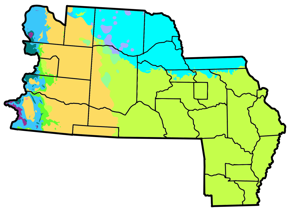
Agreeland has a wide variety of a climate. In the center, east, and south, it is temperate and hot in the summer. Going north it is cooler but still hot in the summer. Out west, in the Rocky Mountains, it is cooler and arid.
Below is the Köppen climate map of the nation.
Districts of Agreeland
For information about Agreeland’s districts, see the districts page.
Demographics
Agreeland has seven official citizens who live within the borders of the nation. Therefore, there is not much demographic data for Agreeland.
The citizens of Agreeland live in the following districts:
Barton: 3
Kansas City: 1
Omaha: 1
Saguache: 1
Tavakiev: 1
The religions in Agreeland are as follows:
Catholic: 3
Irrelegious: 3
Not specified: 1
Government of Agreeland
For information about Agreeland’s government and politics, see the government page.
